NASA's new Mars picture
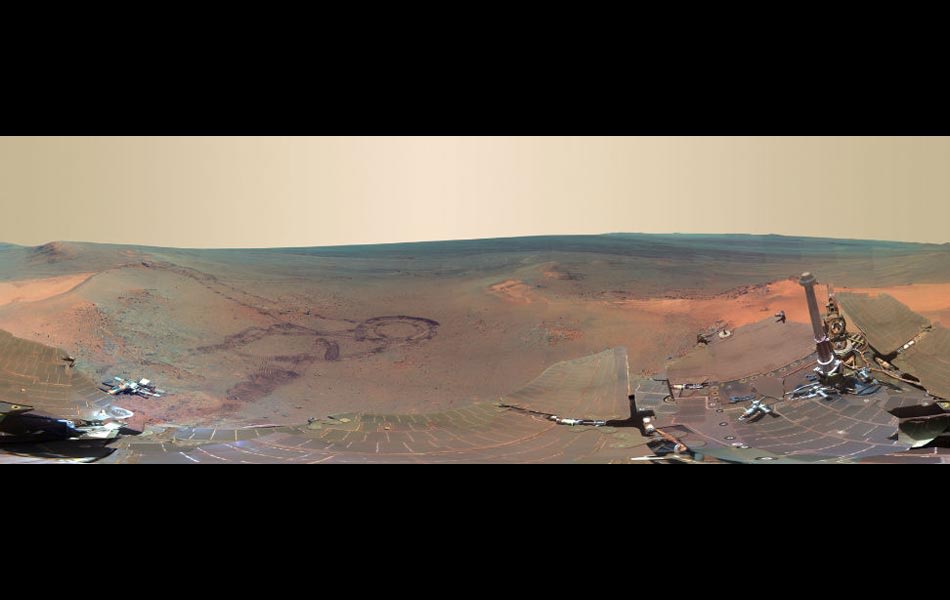
The US space agency NASA has recently pieced together a panoramic view from the camera on NASA's Mars Exploration Rover Opportunity, calling it the "next best thing to being" on the Red Planet.
A full-circle scene combining 817 images taken by the panoramic camera (Pancam) on NASA's Mars Exploration Rover Opportunity. The US space agency NASA is calling it the "next best thing to being" on the Red Planet.
ESA's first mission to the Red Planet is Mars Express. It comprises an orbiter carrying seven scientific instruments to probe the planet's atmosphere, structure and geology, including a search for evidence of hidden water. The main spacecraft will also release the UK's small Beagle 2 lander to gather and test rock and soil samples on the surface. British space probe Beagle 2 failed to broadcast a signal on December 25, 2003, to confirm it had landed on Mars, but scientists said they were waiting for a second contact opportunity later on Thursday. REUTERS/European Space Agency
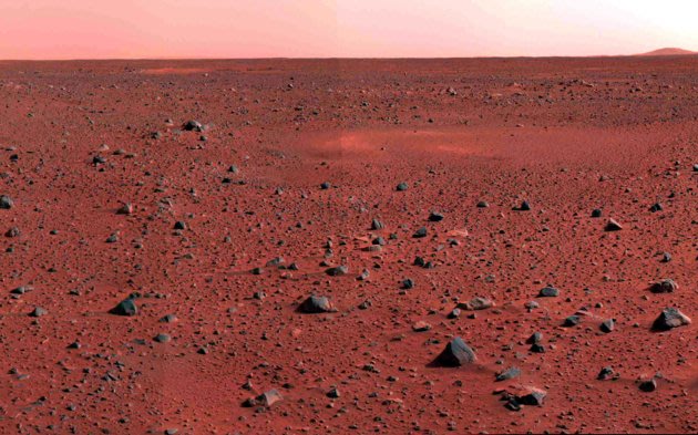
This image mosaic taken by the Mars Exploration Rover Spirit's panoramic camera shows a new slice of martian real estate southwest of the rover's landing site. The landscape shows little variation in local topography, though a narrow peak only seven to eight kilometres away is visible on the horizon. A circular depression, similar to the one dubbed Sleepy Hollow, can be seen in the foreground. Compared to the Viking and Pathfinder landing sites, the terrain at Gusev Crater, Spirit's landing site, is flat and speckled with a sparse array of rocks. The picture was released by the Jet Propulsion Laboratory in Pasadena, California
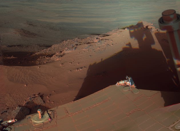
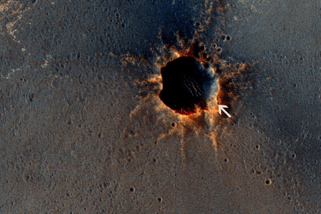
Mars Rover Opportunity catches its own late-afternoon shadow in a view eastward across Endeavour Crater on Mars. The rover used a panoramic camera between about 4:30 and 5:00 p.m. local Mars time to record images taken through different filters and combined into this mosaic view. Most of the component images were recorded during the 2,888th Martian day, or sol, of Opportunity's work on Mars, which corresponds to March 9, 2012 on Earth. The view is presented in false color to make some differences between materials easier to see, such as the dark sandy ripples and dunes on the crater's distant floor. Opportunity has been studying the western rim of Endeavour Crater since arriving there in August 2011.
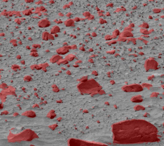
A TextureCam analysis of a Mars image is able to distinguish rocks from soil.
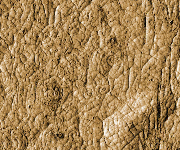
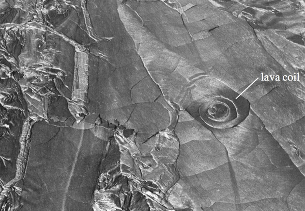
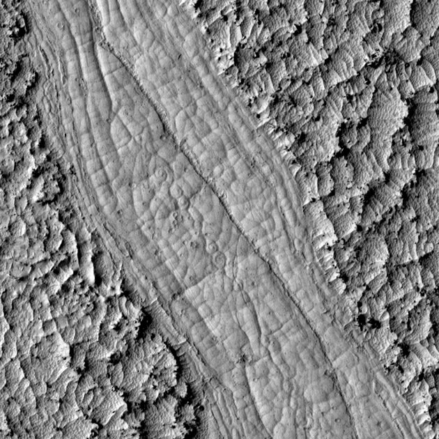
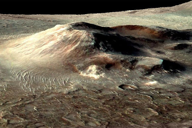
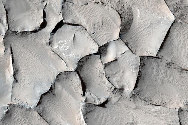
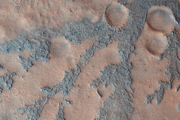
Giant coils of lava on Mars suggest a mysterious network of valleys on the planet was born from volcanoes, researchers say.The origin of the Athabasca Valles region near the equator of Mars has been debated for more than a decade. Some researchers have proposed that lava once shaped the valleys, while others have thought ice was responsible.The way the ground there is patterned with multisided polygons suggests that either fire or ice could be the culprit — such patterns of cracks might have formed due to seasonal fluctuations in temperature if the surface there was rich in ice, but also might have arose as lava cooled and fractured.
These spirals resemble lava coils on Earth, such as those forming on the surface of Hawaiian lava flows. "These can only be explained by lava processes," Ryan said. "There are no known processes to twist ice around on that scale."Future modeling of how these spirals formed can help figure out the composition of these lavas, "which can tell you about the composition of the Martian crust and mantle, things we don't know much about," Ryan said.
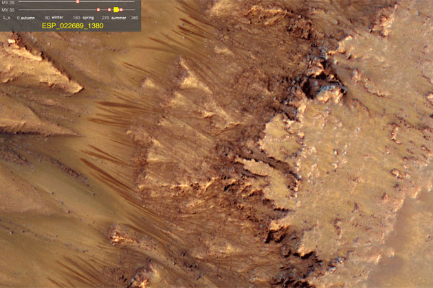
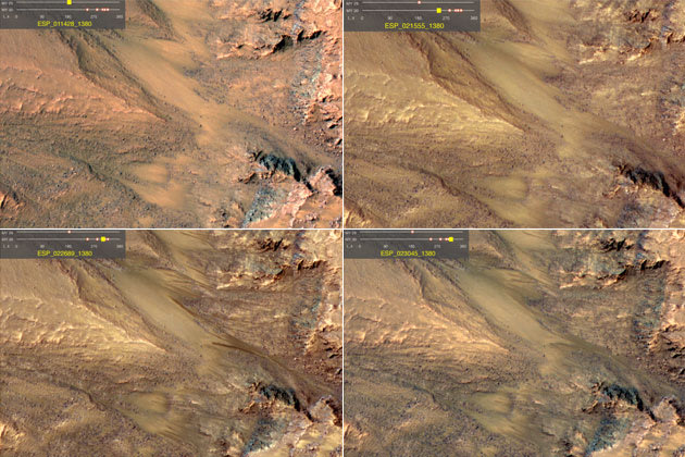
Scientists have found evidence of flowing salt water on steep Martian slopes, which if confirmed would be the first discovery of active liquid water on the red planet, NASA has said.
The data gathered by the Mars Reconnaissance Orbiter has given new focus to the hunt for life forms and scientists hope that in the coming years lab experiments and new space missions may shed more light on what they have seen.
The US space agency said the orbiter circling Mars since 2006 had monitored numerous instances of what appeared to be water flows occurring in several locations during the Martian spring and summer.
No liquid water has been found on Mars, though ice has been discovered at the poles. All life forms need water to survive, so the existence of a water source could point to a haven for primitive life.
Frozen water has been detected in some of Mars's higher latitudes, and other evidence has suggested that water interacted with the Martian surface throughout the planet's history.
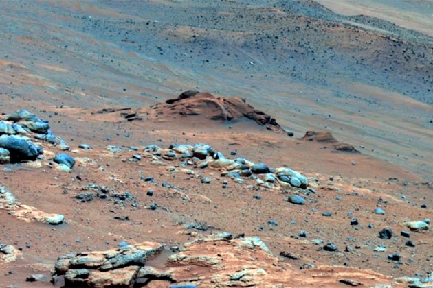
In this image, Comanche is the dark reddish mound above the center of the view. The image is presented in false color, which makes some differences between materials easier to see. It combines three separate exposures taken through filters admitting wavelengths of 750 nanometers, 530 nanometers and 430 nanometers. The main Comanche outcrop is about 5 meters (16 feet) from left to right from this perspective. The paler material visible at bottom right is part of another outcrop, "Algonquin." Image Credit: NASA/JPL-Caltech/Cornell University
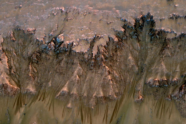
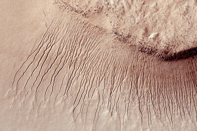
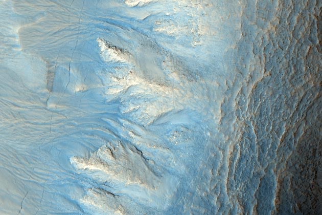
Images like this from the High Resolution Imaging Science Experiment (HiRISE) camera on NASA's Mars Reconnaissance Orbiter show portions of the Martian surface in unprecedented detail. This one shows many channels from 1 meter to 10 meters (approximately 3 feet to 33 feet) wide on a scarp in the Hellas impact basin. On Earth we would call these gullies. Some larger channels on Mars that are sometimes called gullies are big enough to be called ravines on Earth.
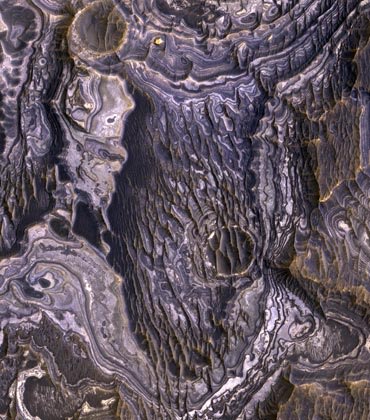
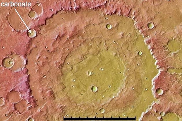
This image shows the context for orbital observations of exposed rocks that had been buried an estimated 5 kilometers (3 miles) deep on Mars. It covers an area about 560 kilometers (350 miles) across, dominated by the Huygens crater, which is about the size of Wisconsin. The impact that excavated Huygens lifted material from far underground and piled some of it in the crater's rim. At about the 10 o'clock position around the rim of Huygens lies an unnamed crater about 35 kilometers (22 miles) in diameter that has punched into the uplifted rim material and exposed rocks containing carbonate minerals. The minerals were identified by observations with the Compact Reconnaissance Imaging Spectrometer for Mars on NASA's Mars Reconnaissance Orbiter.Image credit: NASA/JPL-Caltech/Arizona State Univ.
--
اين ايميل را براي دوستان خود هم بفرستيد.
و به آنها بفرماييد، روي خط پايين كليك كنند تا براي آنها هم مطالب خوب و جالب بفرستيم
http://groups.google.com/group/taf_sar/subscribe
اين ايميل بدليل عضويت شما در گروه تفريح و سرگرمي است.
ايميل گروه اين است. taf_sar@googlegroups.com
اگر از دست ما ناراحت هستيد و نمي خواهيد مطالب ما بدست شما برسد پس خط پايين را كليك كنيد.
taf_sar+unsubscribe@googlegroups.com


هیچ نظری موجود نیست:
ارسال یک نظر